
Broad Horizons and Wider Roads
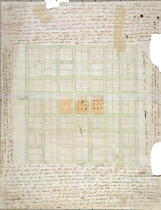
A picture of the document created in 1833 by Joseph Smith called the Plat of Zion.
Have you ever wondered why the streets in towns like Raymond, Magrath, Stirling and Cardston are so wide? It all has to do with a utopian city planning tool designed by founder of the Mormon Church, Joseph Smith, in June 1833 called the Plat of Zion. Plat is a term for land-use maps drawn to scale with property lines.
This Plat of Zion started out as the plan for a city to be called New Jerusalem. Smith prophesied that it would be built near Independence, Missouri. While the city of New Jerusalem was never built by the Mormons, the concept of the Plat indicated that it was to extend from that centre location in a series of grids to fill the region with adjacent city blocks. Brigham Young used the modified versions of the original Plat as the base map for most towns and cities founded by Mormon colonists in Utah, Arizona, Montana, Idaho, Mexico and Canada.
The Plat included the largest city blocks of the time—larger than city blocks in New York or Philadelphia. It also featured huge street allowances for all roadways, a set of central blocks for religious buildings and large property lots. The large size of the lots was an attempt to encourage residents to grow crops, orchards and even livestock. Smith intended for the Plat to house between 15,000 and 20,000 residents, and then to build another city on an adjoining grid.
When Charles Ora Card laid out the plan for Cardston in 1888, the initial layout had a small grid of 12 blocks that each measured 561 feet wide. When Card resurveyed Cardston in 1894, he extended the town’s grid to a square mile with 99-foot-wide roads.
You can learn more about the Plat of Zion and how it was used to establish Mormon communities in southern Alberta at the Galt Museum on September 4 from 2–3 pm when Graham Ruttan will host a lecture entitled The Centre Place.